Thomas Ewing
Architecture + Design
Thomas Ewing
Architecture + Design
Thomas Ewing
Architecture + Design


Great Yarmouth Town Wall
Location: Great Yarmouth, Norfolk
Role: Drone Operator
Stage/Service: Drone Survey
Typology: Scheduled Ancient Monument, 13th Century
Year/Status: 2025
Great Yarmouth Town Wall
Location: Great Yarmouth, Norfolk
Role: Drone Operator
Stage/Service: Drone Survey
Typology: Scheduled Ancient Monument, 13th Century
Year/Status: 2025
Great Yarmouth Town Wall
Location: Great Yarmouth, Norfolk
Role: Drone Operator
Stage/Service: Drone Survey
Typology: Scheduled Ancient Monument, 13th Century
Year/Status: 2025
Great Yarmouth Town Wall
Location: Great Yarmouth, Norfolk
Role: Drone Operator
Stage/Service: Drone Survey
Typology: Scheduled Ancient Monument, 13th Century
Year/Status: 2025
Great Yarmouth Town Wall
Location: Great Yarmouth, Norfolk
Role: Drone Operator
Stage/Service: Drone Survey
Typology: Scheduled Ancient Monument, 13th Century
Year/Status: 2025
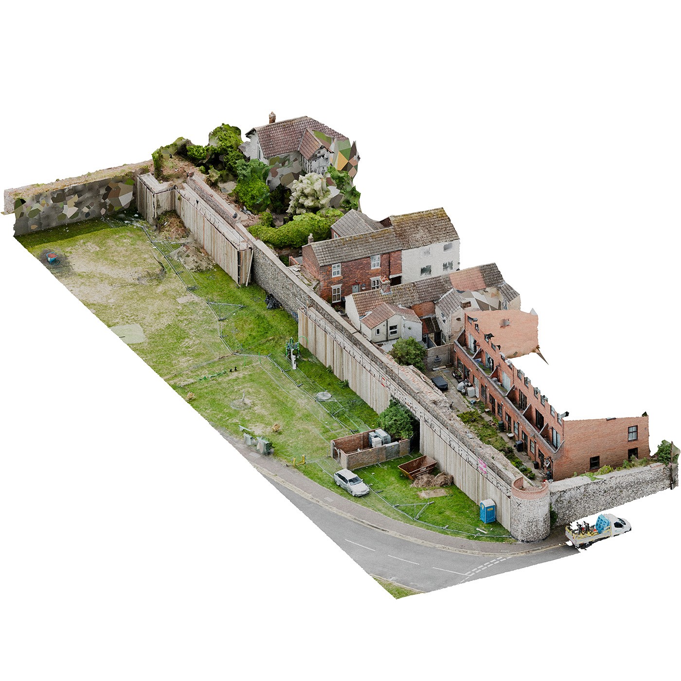
The Great Yarmouth town wall is among the most complete medieval fortifications in England, with substantial surviving stretches and many original towers still standing. Built of knapped flint with later patchwork repairs, it illustrates centuries of adaptation, weathering, and civic investment in the town’s protection. Its survival makes ongoing documentation essential, as the structure is vulnerable to masonry decay, vegetation growth, and environmental exposure.
For this commission, a drone survey was carried out to capture high-resolution imagery of the wall’s upper sections, areas that are difficult or unsafe to inspect from the ground. The aerial data was processed into a detailed 3D photogrammetric model, which provided the basis for a set of scaled elevations used directly by conservation teams on site. These drawings supported precise condition annotations, accurate area measurements, and reliable record-keeping for the repairs.
The workflow offered a fast and non-intrusive method of documenting a complex historic structure, producing a clear and repeatable reference that supports informed conservation decisions and long-term maintenance planning.
Newton Hall, a scheduled ruin in Norfolk, presents a complex mix of surviving medieval and post-medieval masonry. The standing walls show extensive weathering, structural movement, and patchwork repairs that make a conventional survey unreliable. To document the site accurately, I carried out a full photogrammetric scan of the remaining fabric and used the resulting model to produce detailed orthographic elevations.
The drawings mapped the condition of every accessible face of the ruin, including areas of masonry loss, differential decay, open joints, vegetation growth, and historic interventions. Each elevation was annotated with targeted remedial recommendations, ranging from selective repointing and consolidation to vegetation removal and localised rebuilding, providing a clear framework for conservation-led repair.
The exercise served as a useful case study in how digital survey methods can support the stewardship of fragile heritage assets. Using photogrammetry allowed the structure to be recorded with a level of precision that would be impractical through traditional methods, producing a durable record that can inform future repair, monitoring, and management of the site.
© 2025 Thomas Ewing. All rights reserved.
© 2025 Thomas Ewing. All rights reserved.